


These New Google Maps Features Will Help You Navigate National Parks
Updated: Mar. 19, 2024

These updates will make park navigation SO much easier.
As home to some of the most magnificent views, attractions and endless activities in America, it’s no wonder national parks are once again approaching pre-pandemic visitation levels. In 2022 alone, national parks and sites welcomed nearly 312 million recreational visitors. In 2023, the rising number of national park visitors shows no signs of slowing down. Some of the most popular national parks—like Acadia, Zion and Yosemite—will even require reservations this year in anticipation of the high amount of travelers.
When it comes to navigating the parks, however, it isn’t always so easy. Unless you’re a national parks expert or have a knack for directions, navigating the parks can be challenging at times. Especially for those visiting the parks for the first time.
That’s why Google Maps and the National Park Service (NPS) have teamed up to help visitors travel through the parks more conveniently thanks to the creation of four new Google Maps features. Whether solo traveling or taking a family vacation, the new features certainly simplify any national parks trip.
How were the new Google Maps features created?
To create these new helpful features, Google Maps utilized the insight of national park rangers and directors. As a result, these Maps updates encapsulate what is most helpful to park visitors.
“With these updates, everything from finding your way around a park to discovering things to do when you’re there will feel like, well, a walk in the park,” says Michael Curtes, group product manager of Google Maps.
What are the new Google Maps features?
There are four new features that Google Maps has created for iOS and Android to help visitors explore national parks more easily:
1. Effortlessly check out the most popular park attractions
Oftentimes, planning is one of the most time-consuming parts of any trip. Deciding what attractions to see and in what order to see them in can be tedious.
“Now,” writes Curtes, “you can quickly identify the most popular places in a park—like attractions, campgrounds, visitor centers. and trailheads.” Here’s how it works. After a park is searched for in Maps, photo highlights of key attractions will pop up along with details, videos and reviews from other travelers—making planning or exploring any major site a breeze.
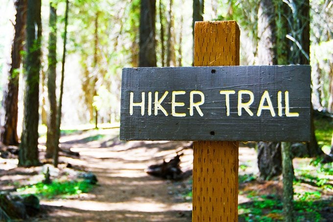
2. Fully map out park trails
Whole trail routes will now be highlighted for users within maps, making them much easier to navigate. Previously, a pin showing solely the center of the trail was offered to users. Additionally—similarly to the park attractions feature—users will be able to access trail reviews, difficulty and photos. Plus, users will receive insight into what type of trail it is and if the trail is best for running, walking or cycling.
3. Navigate parks with more detailed directions
Not one for directions or navigation? This next feature takes care of that. Now, more detailed park directions will be available for travelers. Key park locations like entrances will be highlighted on maps. As a bonus, when choosing whether to walk or cycle a specific park trail, Google Maps will point users to the proper trailhead.
4. Download park maps for offline access
One of the largest challenges when hiking can be losing cell service—especially if a phone holds vital hiking directions. Google Maps simplifies the adventuring process as a map of each national park hiking trail can be downloaded. All users will need to do is “tap the ‘download’ button on the park’s Google Maps listing,” Curtes explains. Then, with or without cell service, visitors can navigate any national park hiking trail with ease.
When will the Google Maps features be available?
Fortunately, the attraction and trail features are already available in certain parks like Yellowstone and Yosemite. As for the remainder of U.S. national parks and features, they will continue to launch on Google Maps through the month of April. Globally, the features will launch over the next few months.


Sources:
- Condé Nast Traveler: “These Are the National Parks Requiring Reservations in 2023”
- Google Blogs: “4 Map updates to help you explore U.S. national parks”
- National Parks Service: “Annual Visitation Highlights”