

Knowing These 6 Types of Clouds Can Help You Predict the Weather

Updated: Dec. 16, 2022
Most likely you turn to your local weather report to find out what the day will be like, but looking at the clouds can help too.

Cirrus
You most likely turn to your local weather report to find out what the day will be like, but looking at the clouds can help too. These common types of clouds will help you decide if you should move your party inside. Here are the things your weatherman won’t tell you.
Type of cloud: Cirrus
Thin and wispy, they can appear in a variety of shapes
Most likely weather
Approaching front and stormy weather.

Cirrocumulus
Type of cloud: Cirrocumulus
Small, rounded white puffs. Isolated or in long rows.
Most likely weather
These clouds indicate fair but cold weather.

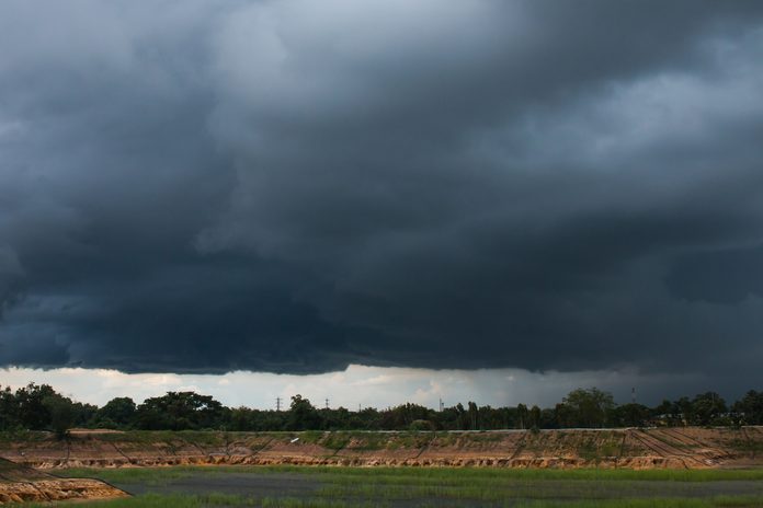
Cumulonimbus
Type of cloud: Cumulonimbus
Heavy dense clouds in the form of mountains or towers.
Most likely weather
Heavy showers with thunder and lightning or hail. But did you know that lightning doesn’t have to happen every time it rains? Learn more weird lightning facts that could help you in a thunderstorm.
Nimbostratus
Type of cloud: Nimbostratus
Dark, low uniformly gray clouds.
Most likely weather
Widespread light to moderate precipitation.

Cirrostratus
Type of cloud: Cirrostratus
Sheetlike clouds covering the entire sky.
Most likely weather
May signal precipitation within 15-25 hours.

Cumulus Humilis
Type of cloud: Cumulus Humilis
Small puffy clouds with minimal vertical development
Most likely weather
Fair weather. Never produce precipitation.
Next, check out the crazy times the weather changed the course of history.