

12 Genius Google Maps Settings That’ll Make Your Life Easier

Updated: Jul. 25, 2023
These smart Google Maps settings are guaranteed to make your life easier
Google Maps settings that make life a little easier
Chances are, you use Google Maps on the regular. But are you fully taking advantage of the Google Maps settings that’ll make your life infinitely easier? The tool offers so much more than just driving directions, a snapshot of where you’ve been via Google’s My Activity and a view of your house using Google Street View. It can help you find a restaurant when you’re away from home with a grumbling stomach, pinpoint wheelchair-accessible locations, avoid heavy traffic and much more.
To help you make the most of the platform, we’re rounding up some Google Maps settings and Google tricks you probably don’t know about—but will wish you’d been using all along. Add these to your vast Google knowledge, along with tips on how to turn off Google Assistant and things to never google.
Get Reader’s Digest’s Read Up newsletter for more tech, humor, cleaning, travel and fun facts all week long.
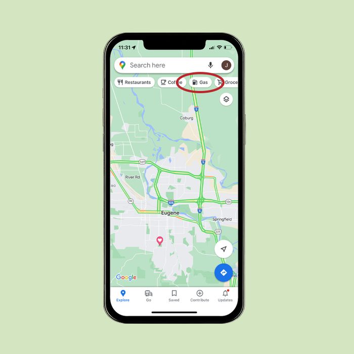
Find a gas station, restaurant and more
Need to fill up your tank or your tummy? Don’t bother opening a web browser to do a search. Google Maps can mark these landmarks (and others) on the map automatically. All you need to do is tap the “Restaurants” or “Gas” button at the top of the Maps home screen. Not only can you see relevant pins on the map, but you’ll also get a list of locations, their Google star ratings and all the need-to-know info about them.
Alongside restaurant and gas buttons, you’ll spot location-finding buttons for grocery stores, parks, hotels, coffee shops, convenience stores and other places you may be searching for.
Worried about what others may see should their search lead them to your neighborhood? If you’re concerned about privacy, you can blur out your house on Google Maps.
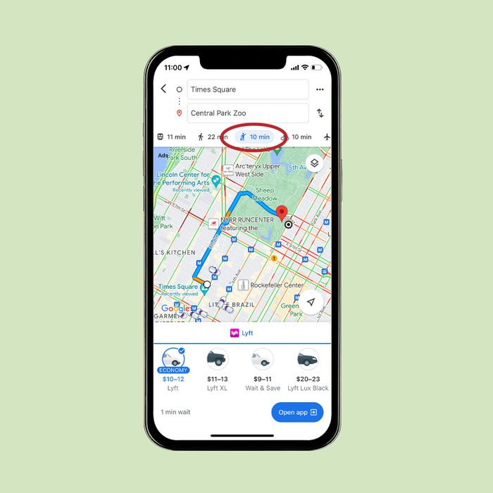
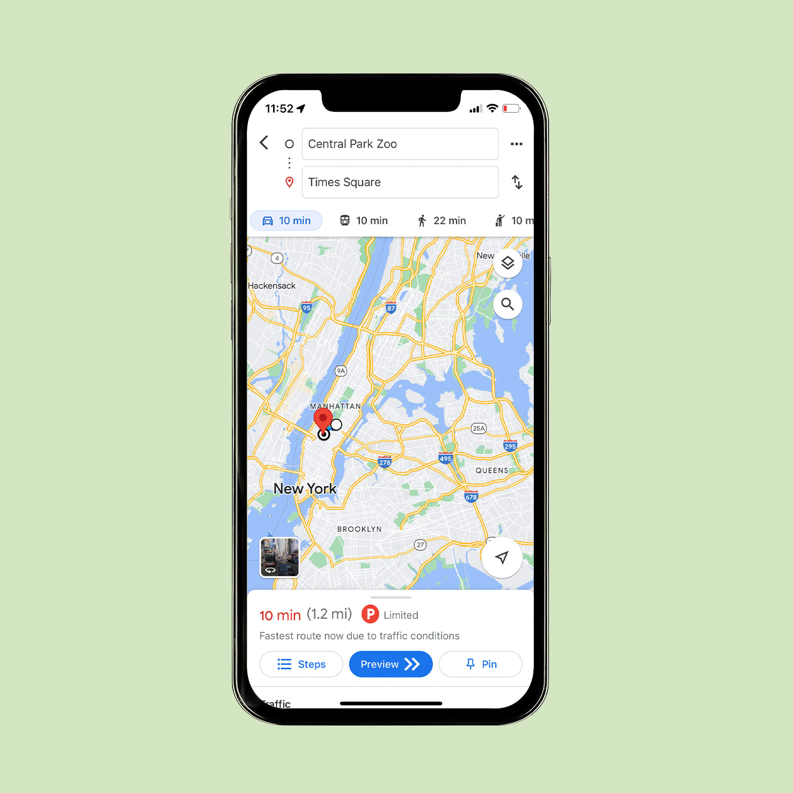
Price shop for ride-shares
Everyone knows how annoying it is to type your destination into each of your ride-sharing apps to see which is the cheapest. Not even the best Uber hacks will save you from the hassle. Fortunately, the mobile version of Google Maps can help you view all the options in one place.
Simply type your destination into the search box, select “Directions” and then add your starting location. Tap the icon of the person hailing a cab—you’ll find it in the list right below your destination. Google Maps will show you each ride-sharing service in the area, as well as the cost of each travel option. With Uber, for example, you’ll see UberPool, UberX, UberXL and so on. Of note: You’ll still have to go to the ride-sharing service’s app to request your ride.
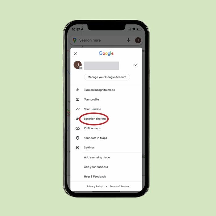
Share your location by adjusting your Google Maps settings
Heading out on a weekend trip and want to make sure your otherwise anxious mom or best friend can follow along? Google Maps allows you to share your location. You can even customize the length of time this info is available so your friends or family don’t snoop too often.
To share, tap on your account icon and then “Location Sharing.” Tap “Share Location” and choose how long you want to share your location and with whom you want to share it. You can also share across third-party apps like Facebook Messenger, Line, WhatsApp and more.
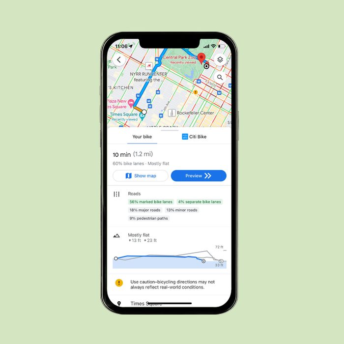
Find a bike path
Biking in an unfamiliar place can be intimidating—especially when you don’t know what types of paths to expect. Google Maps has your back. You just need to tweak your Google Maps settings. Enter your destination in the search box, select “Directions” and then type your starting location. Next, select the icon of a person riding a bicycle.
From there, you’ll see routes that feature cycling options, directions and a graph of how flat (or hilly) the various routes are. If you want to see what the terrain will be like, select the “Layers” icon (it looks like a stack of paper) and choose “Terrain.”
Psst! Google will often fill in your starting destination for you, but if that gives you privacy concerns, there’s a fix: You can turn off your location services.
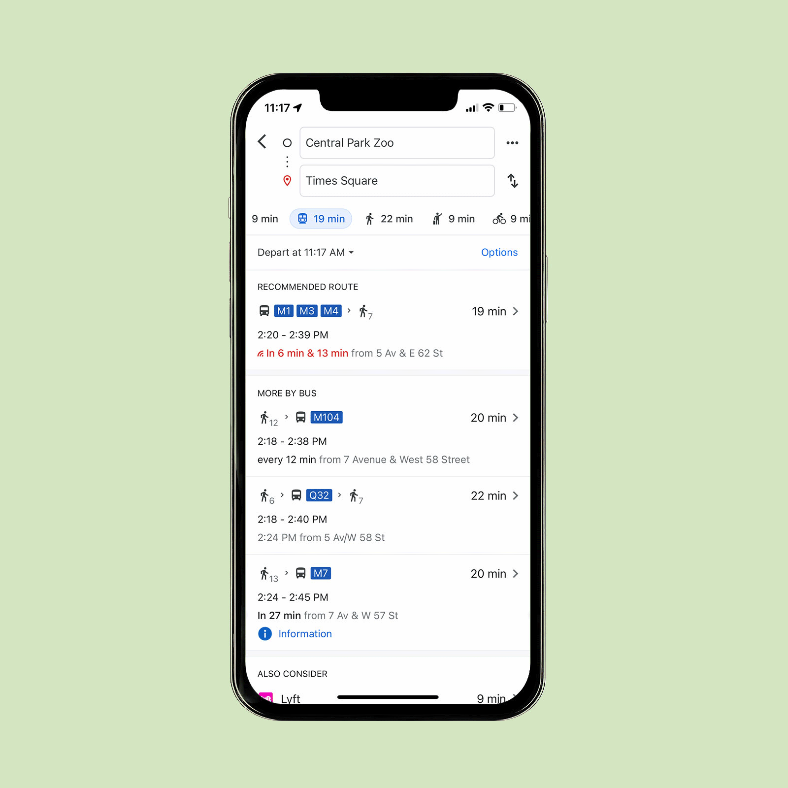
Find public transit
Finding the nearest bus or train in a new location can be tough, but it’s often necessary. (Alas, self-driving cars aren’t commonplace yet.) Google Maps makes it easy. Just head to the “Layers” icon, select “Transit” and all the local transit options near you will appear on the map.
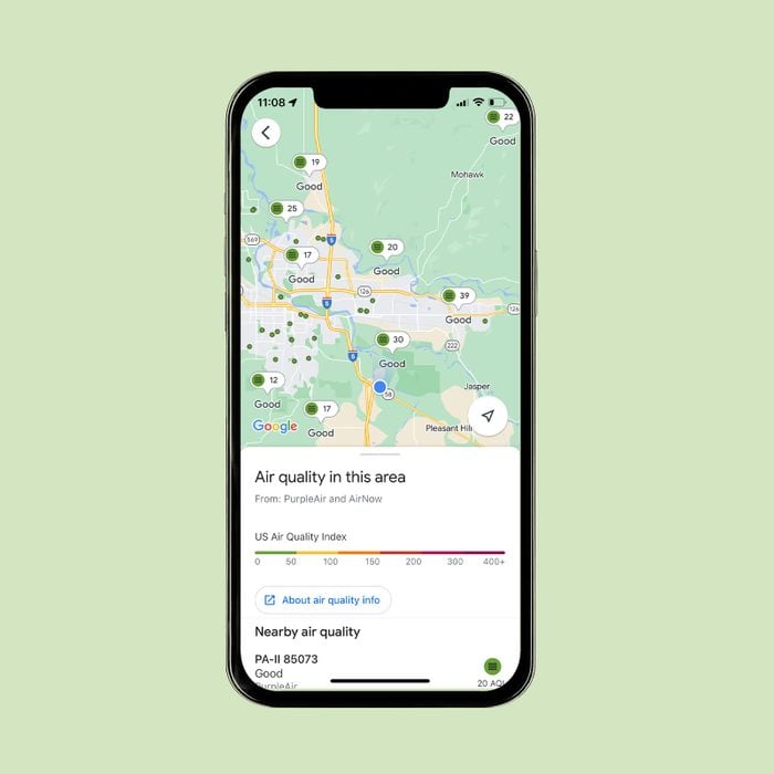
Check your local air quality
Got allergies and want to see what the air quality is like before you step outside? No problem. Open Google Maps, select the “Layers” icon and choose “Air Quality” from the menu. The air quality index for your location will pop up.
Want more tips for navigating the ups and downs of Google products? Learn what Google knows about you—and what you can do about it.
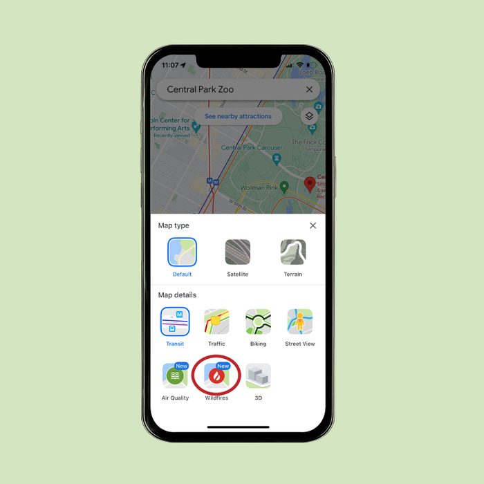
Find out if wildfires are nearby
Wildfires can happen across the country, and it pays to stay informed. Instead of asking Google Home about wildfires in the area, find out how close a wildfire is to you by using Google Maps. In the “Layers” feature, choose “Wildfires.” A map of your location will pop up, along with red dots that indicate local wildfires.
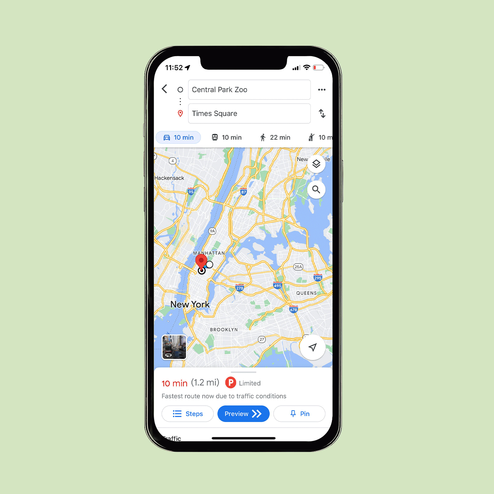
Know what to expect from traffic
Headed to a congested area for a reservation? It can be hard to know when to leave. Get a feel for what traffic is typically like with traffic data from Google.
Enter your destination and tap “Directions,” then add your starting location. Select the type of transportation you’re taking—look for the car, train, walking, biking and ride-share icons—and select the “Layers” icon. There, you’ll want to choose “Traffic.” You’ll be able to see where and when trouble is likely to occur. You can set an arrival time and even schedule an alarm to make sure you leave early enough to avoid gridlock.
Wondering how Google can offer up such useful information? Here’s how GPS works.
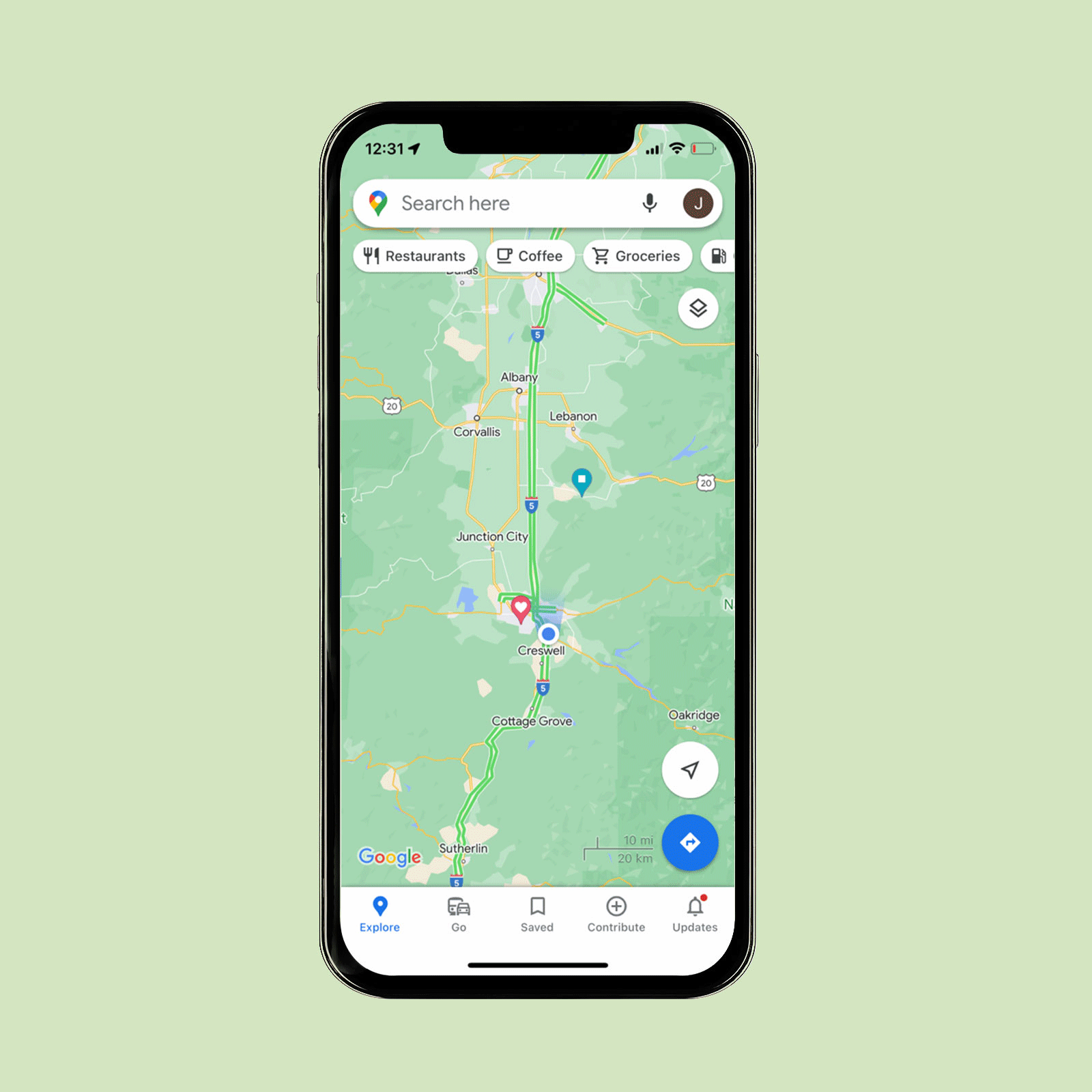
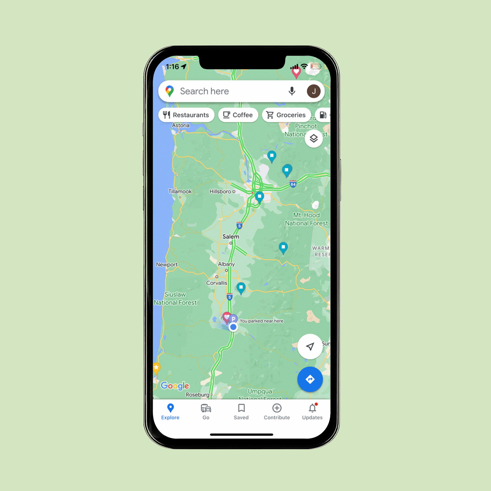
Remember where you parked
At the mall or any large parking area, you might want a helping hand in remembering where that precious spot is located. The Google Maps app has you covered. Android users can tap the blue location dot and then tap “Save Parking” to add their parking location to the map. There will be a label on the map showing where you parked your car. Tap on that label to open up your parking card. There, you can add relevant details and even schedule a reminder to alert you 15 minutes before your meter expires.
The iPhone experience is similar. Tap on the blue dot and then tap on “Set as Parking Location” to add your parking spot. Then tap on the parking label on the map to open up your parking card. If that blew your mind, check out these other iPhone hacks you probably don’t know about.
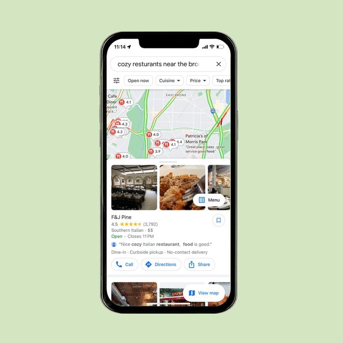
Find anything, anywhere
You probably already know that you can type “coffee shop near me” into Google Maps to get a list of coffee shops in your area. But did you know you can search destinations even if you’re a thousand miles away? You can! Give it a try: Search “cozy restaurants near the Bronx Zoo” or “beer halls near the White House.”
Talk about easy date-night planning! A word of caution for anyone using these Google Maps settings to plan a surprise outing: With the My Activity feature, anyone with access to your Google account can view all your online activity—even the places on Google Maps you’re including in that super-secret anniversary getaway. To get around this, tap on your user name icon in the right corner and turn on Incognito Mode in the drop-down menu.
Find wheelchair-accessible places by adjusting Google Maps settings
Learn whether a business is wheelchair accessible before you arrive with the app version of Google Maps. Start by tapping your account icon. Next, select “Settings” and then “Accessibility.” Toggle on “Accessible Places.” Now, when you search a location, information about the building’s accessibility will be included in the results if the information is available.
Find a wheelchair-accessible route for public transit
It can be frustrating to set out on a trip using public transportation without knowing whether the entire route is accessible. Make sure you take the best route by using Google Maps’ accessibility feature. Enter your destination, select “Directions” and choose the public transportation icon. Select “Options” (in blue) and pick the wheelchair-accessible choice.
Now that you’re a whiz when it comes to Google Maps settings, learn how to avoid common Google Voice scams.
Originally Published: September 17, 2018